You need the plan of a parcel. It may be for a project, to measure a property, to prepare a subdivision or simply to see where the boundary runs.
And you have hit the usual problem: you can see the parcel on screen, but getting it out of there and into your software is another story.
This guide explains the three different things people call "cadastral plan" (plano catastral) in Spain, and how to get each one.
What exactly the cadastral plan is
When someone asks for "the plan", they usually want one of these three:
The cadastral mapping: the drawing of the parcel's boundaries on the ground. It is what you see in the viewer: the outline with its shape and its neighbours around it.
The parcel sketch (croquis): the official graphic sheet, with the dimensioned outline, the area and the cadastral reference. It works as a document.
The geometry as a file: the outline's coordinates in a format AutoCAD, QGIS or a GPS can read. It is what you need if you are going to work with the parcel, not just look at it.
All three come from the same source, but you get them in different ways.
See the plan over the satellite image
The first and most useful thing to get your bearings is to see the boundaries on top of the orthophoto. That way you can check at a glance whether the cadastral boundary matches what is on the ground: the fence, the track, the real boundary.
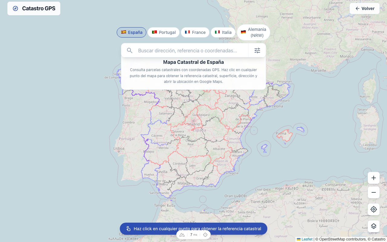
On the cadastral map, the official mapping of the Spanish Directorate General for the Catastro is overlaid on the satellite view:
- Open the map and search by cadastral reference, by address or by tapping directly on the parcel.
- You will see the outline drawn over the aerial photo.
- A card opens with the area, use, year of construction and the GPS coordinates of the centre.
This is free and needs no sign-up. The Catastro GPS app shows the same outline on your phone, with your position on it.
Download the geometry for AutoCAD, QGIS or a GPS
This is where looking becomes working.
If you need the outline inside your software, you can export the parcel in three formats, depending on where it is going:
| Format | What it is for |
|---|---|
| DXF | AutoCAD, BricsCAD, ZWCAD and any CAD. The outline comes in as a polyline, ready to dimension or to build the project on |
| KML | Google Earth. You open the parcel with its boundaries drawn on the globe, useful for showing it to someone |
| GPX | Field GPS, Garmin or a hiking app. You take the outline to the land and see it as you walk over it |
DXF is the one technicians look for: it saves you redrawing the boundary by hand from a screenshot, which is what people do when there is no other option and where half the errors creep in.
Export is part of the Pro plan. Viewing the plan on screen is not: that is free.
Coordinates and the reference system
A detail that matters if you are going to work with precision.
The Catastro publishes in ETRS89 UTM, zone 30 for most of the Peninsula, 29 in Galicia and the west, and 31 in Catalonia and the Balearic Islands. The Canary Islands use REGCAN95.
The coordinates you see on screen are in decimal degrees (WGS84), which is what Google Maps and navigation apps understand. If your project is in UTM, check the zone before importing: it is the most common mistake and produces shifts of hundreds of kilometres that are spotted straight away... or of a few metres, which are never spotted.
The important warning: the cadastral boundary is not the legal boundary
This needs saying clearly, because it saves trouble.
The Catastro is a tax register, not a property register. Its mapping describes the parcel for tax purposes, and its boundary is an excellent reference for getting your bearings, valuing or negotiating.
But it does not legally define the property. That is the job of the Land Registry (Registro de la Propiedad), and fixing a boundary on the ground requires a survey by a qualified professional.
If you are going to subdivide, sell, build on the boundary or settle an argument with a neighbour, the Catastro DXF is your starting point, never your final document.
Frequently asked questions
Can I see the plan without signing up? Yes. Viewing the mapping and the parcel's outline on the satellite image is free.
Does the DXF include dimensions? It contains the boundary geometry as a closed, georeferenced polyline. Your CAD generates the dimensions from it.
Does it work for rural and urban land? Both. On rural land the outline usually matches what you see on the orthophoto quite closely; in urban areas, in built-up blocks, the parcel may appear divided into construction units.
And in Navarre or the Basque Country? They have their own cadastres (IDENA in Navarre, and the provincial councils in Álava, Bizkaia and Gipuzkoa). They are covered, although the level of detail varies by territory.
Can I submit it to a town hall? Not as an official document: for that you use the descriptive and graphic certificate (certificación descriptiva y gráfica) from the Catastro's Sede Electrónica. For working, measuring or designing, yes.