
You locate parcels every day. You check boundaries. You prepare surveys.
And every time you repeat the same routine: look up the reference, note the UTM coordinates, convert them to WGS84, load them into the field GPS.
Catastro GPS removes those repetitive steps.
The problem it solves
The traditional workflow to locate a cadastral parcel in Spain:
- Look up the cadastral reference
- Note the UTM coordinates (EPSG:25830)
- Convert them to WGS84 by hand
- Enter the coordinates into the field GPS
- Repeat for every parcel in the project
With a project of 45 parcels, that takes hours.
With Catastro GPS: you enter the 45 references, export to GPX and load them into your GPS. All in minutes.
Quick single lookup
To locate a specific parcel:
- Open the search page.
- Enter the cadastral reference.
- Get the GPS coordinates instantly.
- Copy them or open them in Google Maps.
On your phone in the field: use the browser or the Catastro GPS app, which also shows your own position on the parcel boundaries. It works on mobile data.
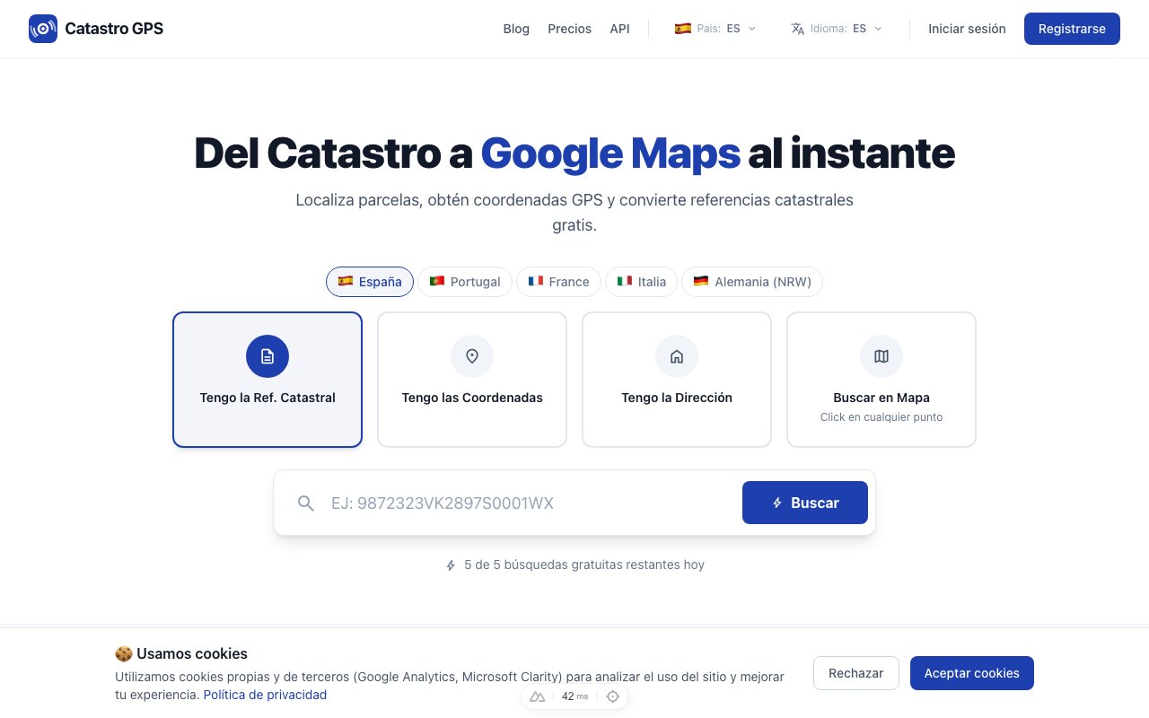 Enter the reference and get the coordinates in under 3 seconds
Batch lookups (Pro plan)
This is where Catastro GPS makes the difference for a surveyor.
With the Pro plan you can look up many cadastral references at once:
- Paste a list of references (separated by commas or line breaks)
- Get all the coordinates in one go
- Export the whole batch to KML or GPX
When you will use it
| Situation | Example |
|---|---|
| Development project | 45 parcels in a housing estate |
| Area survey | Every property in a polígono |
| Property inventory | 200 properties of an agricultural cooperative |
| Bulk check | A client's list of parcels |
Export to KML (Google Earth)
KML is Google Earth's standard format. With Catastro GPS Pro you export a KML file that includes:
- Placemarks with the location of each parcel
- Name with the cadastral reference
- Description with address and coordinates
How to use it
- Export the KML file from Catastro GPS.
- Open Google Earth Pro (free).
- Go to File > Open and select the KML.
- You will see every parcel on the 3D map.
What it is for in surveying
- Seeing the full set of parcels in a project in satellite view
- Sharing the parcel locations with the field team
- Overlaying them with orthophotos, DTMs or other layers
- Planning the day's logistics before heading out
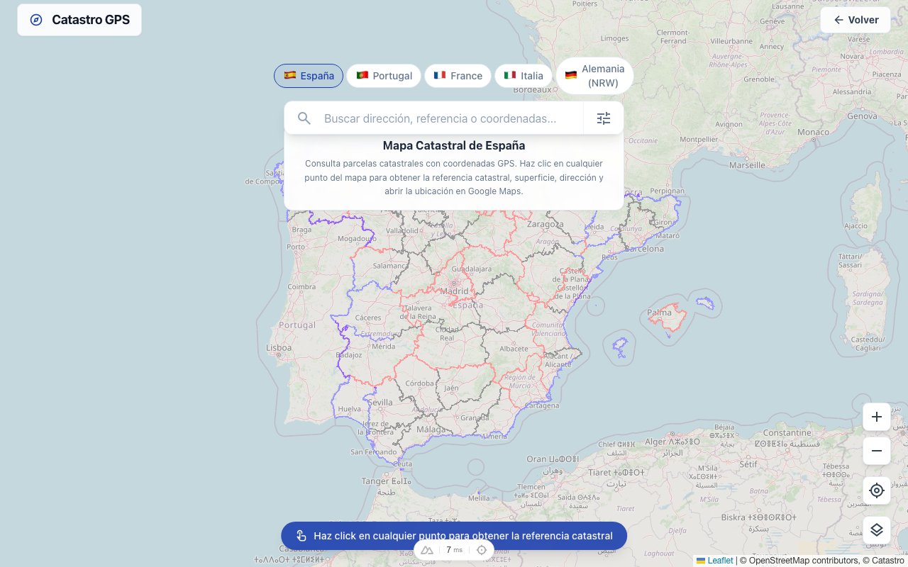 See every parcel in your project on the map before going out
Export to GPX (field GPS)
GPX works with the devices you already use: Trimble, Leica, Garmin and most navigation apps.
Step by step
- Export the GPX file from Catastro GPS.
- Connect your GPS to the computer by USB.
- Copy the file into the waypoints folder.
- On the GPS, select the waypoint and navigate to the parcel.
No more converting coordinates by hand. The GPX comes out in WGS84, ready for your device.
 Load the waypoints straight into your GPS and navigate to each parcel
Search history
With the Pro plan, every search is saved automatically:
- Date and time of the lookup
- Coordinates obtained
- Cadastral reference and address
What it is for
| Need | Solution |
|---|---|
| Recover yesterday's coordinates | Look in the history instead of searching again |
| Record of parcels looked up | The history is your project log |
| Export data to your software | Download the history as CSV |
Working with your software
The KML and GPX files import directly into GIS software:
QGIS
- Layer > Add Vector Layer
- Select the KML or GPX
- The points appear as a layer you can reproject and combine with others
AutoCAD
- Use the MAPIMPORT command or a plugin such as FME
- Import the KML as geometry
- Set the coordinate reference system and you are done
Real cases
Surveying a housing estate
A surveyor receives a project with 45 parcels. They enter the 45 references, export to GPX and load them into their Trimble. In the field they navigate straight to each parcel without looking them up one by one.
Checking disputed boundaries
An owner disputes the limits of their property. The surveyor looks up the parcel and its neighbours, exports to KML and overlays it with their GPS measurements to identify the discrepancies.
Inventory for an agricultural cooperative
A cooperative needs to geolocate 200 properties. With batch lookups it gets all the coordinates in minutes and builds a Google Earth map showing the full distribution.
Free and Pro
| Feature | Free | Pro |
|---|---|---|
| Single lookup | Yes, for occasional use | Unlimited |
| Batch lookups | No | Yes |
| KML export | No | Yes |
| GPX export | No | Yes |
| History | No | Full |
| Favourites | No | Yes |
It pays for itself on the first day. If you look up parcels every day, the Pro plan saves you hours of manual work each week.
Try it now on the Parcel GPS home page. Everyday lookups are free.