You look up a parcel in the Spanish Catastro and get something like this:
X: 441,325.50 m
Y: 4,474,352.30 m
You try pasting that into Google Maps and... it does not work.
Those are UTM coordinates. Your phone uses GPS coordinates. They are different systems.
The conversion happens automatically when you search. But if you want to understand what is going on, read on. UTM coordinates are measured in metres. GPS coordinates are measured in degrees. Two ways of saying the same thing.
The short version
| System | Format | Who uses it |
|---|---|---|
| UTM (EPSG:25830) | X: 441325, Y: 4474352 | Spanish Catastro, official mapping |
| GPS (WGS84) | 40.416775, -3.703790 | Google Maps, Apple Maps, your phone |
The Catastro speaks UTM. Your phone speaks GPS.
Catastro GPS translates between the two automatically.
What UTM coordinates are (in plain terms)
UTM stands for Universal Transverse Mercator.
It is a system that divides the Earth into 60 vertical zones. Within each zone, positions are measured in metres from a reference point.
Why Spain uses it
Three practical reasons:
- Distances are in metres, which makes it easy to measure parcel areas
- It is the European standard (INSPIRE directive)
- It has been Spain's official system since 2007 (Royal Decree 1071/2007)
The exact code is EPSG:25830: ETRS89 datum, UTM projection, zone 30 North. Most of the Iberian Peninsula falls in zone 30.
The problem for you
UTM coordinates are perfect for professional mapping.
But you cannot paste them into Google Maps. You cannot use them in your GPS. They mean nothing to most apps on your phone.
You need to convert them to latitude and longitude.
What GPS coordinates (WGS84) are
They are the ones you use every day without knowing it.
Latitude: 40.416775
Longitude: -3.703790
When you share a location on WhatsApp, when you navigate with Google Maps, when your phone tells you where you are: all of that is WGS84.
It is the system every GPS device in the world understands.
How the conversion works
You enter a cadastral reference on the Parcel GPS home page and this happens:
- The cadastral data is looked up and its UTM coordinates obtained.
- The mathematical transformation from EPSG:25830 to WGS84 is applied.
- You get latitude and longitude, ready to copy or open in Google Maps.
All in under 3 seconds, with centimetre precision.
You do not need to know anything about UTM. Enter the cadastral reference and the rest is done for you. On your phone, the Catastro GPS app does the same and takes you to the plot.
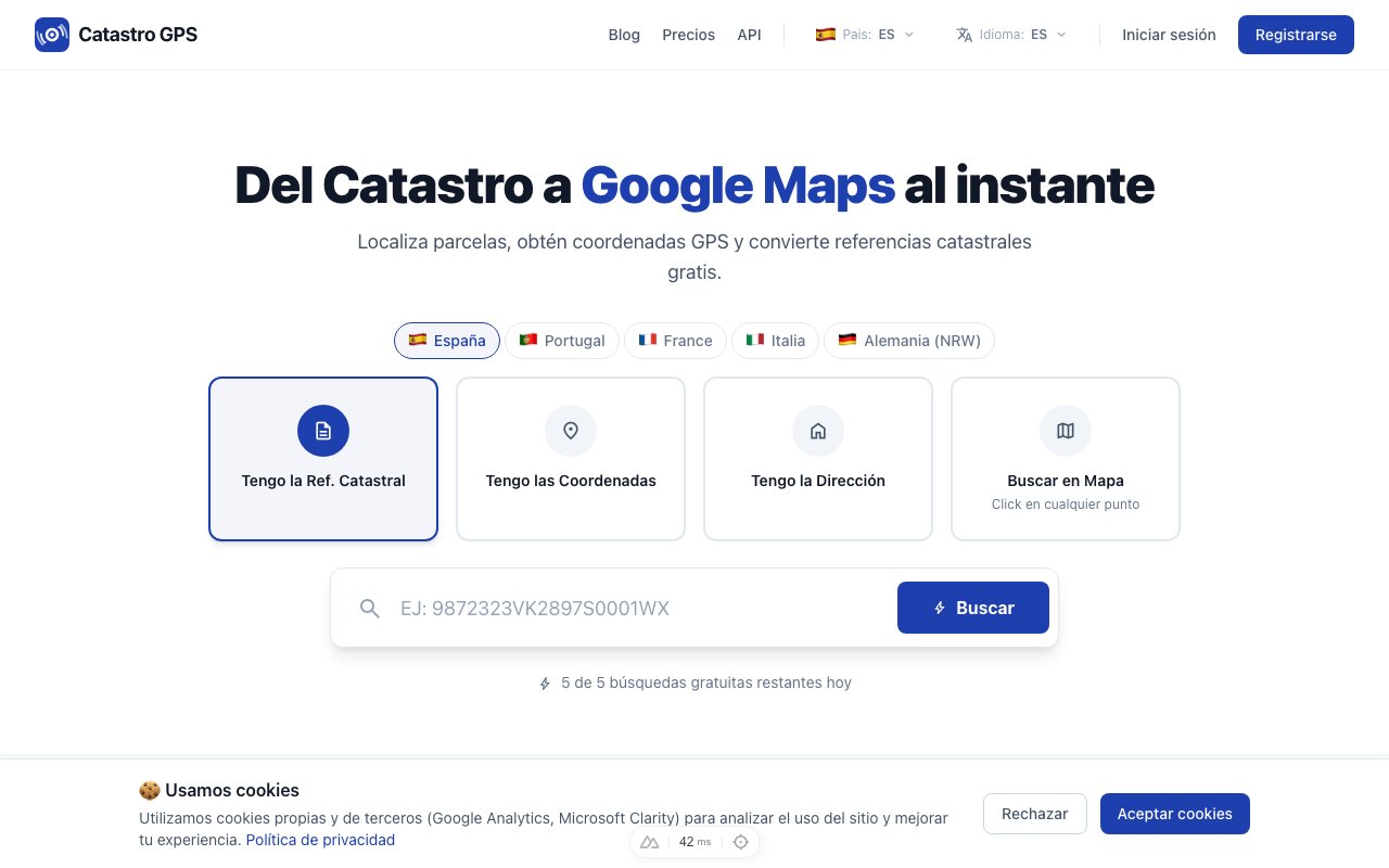 Enter the cadastral reference and get GPS coordinates directly
What if I need to convert by hand?
Sometimes you have UTM coordinates from another source (a plan, a survey report, a GIS file) and need to convert them without a cadastral reference.
The conversion is not trivial
It involves power series, ellipsoid eccentricities and the constants of the UTM zone. Nobody does it by hand.
Tools that do it
| Tool | Type | For whom |
|---|---|---|
| Catastro GPS | Web, free | Anyone |
| QGIS | Free GIS software | Technicians and professionals |
| PROJ | Command line | Developers |
| IGN calculator (Spain's National Geographic Institute) | Web | Occasional use |
The fastest way: if you have the cadastral reference, use the search page. If you only have the UTM coordinates, you can type them straight into the same search box.
How accurate the conversion is
Good news: the conversion between ETRS89 (Catastro) and WGS84 (GPS) is practically exact.
The difference between the two systems is under 1 metre. To locate a parcel, navigate to it or check its boundaries, that is more than enough.
 The conversion is accurate: the parcel appears exactly where it should on Google Maps
Practical cases
See a cadastral parcel on Google Maps
The most common case. You have the reference from the IBI tax bill and want to go to the land. It is converted and opened in Google Maps in one click.
Load cadastral data into a field GPS
Surveyors work with precision GPS units that accept WGS84. With the Pro plan they export to GPX and load the waypoints straight onto the device.
Use the data in web applications
If you are building an app that shows parcels on a map (Leaflet, Google Maps API), you need WGS84 coordinates. The conversion is done for you.
Combine data from different sources
When you mix Catastro data with SIGPAC or other sources, they all have to be in the same system. Converting to WGS84 brings everything together.
Summary
| Situation | What to do |
|---|---|
| You have a cadastral reference and want GPS | Enter the reference on the search page |
| You have loose UTM coordinates | Type them straight into the search box |
| You need to export to a field GPS | Use the Pro plan and export to GPX |
| You need the parcel on Google Maps | There is a direct button |
You do not need to understand the maths. It is done for you.
Try it on the Parcel GPS home page. Free.