Gemarkung Lindenthal, Flur 4, Flurstück 123/5.
If you are reading that for the first time, it sounds like a code only notaries and surveyors understand.
In fact there is a fairly logical system behind it, and once you understand it you can find any plot in Germany.
What is a Flurstück number?
A Flurstück number is the unique identifier of a parcel in the German Liegenschaftskataster (real estate cadastre).
The Liegenschaftskataster is the official register of all land parcels in Germany. It records where a parcel is, how big it is and how it is used. It is kept by the cadastral offices of each federal state.
The Flurstück number on its own does not uniquely identify a plot: it must always be given together with the Gemarkung and the Flur.
The three parts: Gemarkung, Flur, Flurstück
Gemarkung
The Gemarkung is a historical administrative term for a particular area, the cadastral district. Originally it often corresponded to a municipality or a village.
Today Gemarkungen do not always match current municipal boundaries; especially after the municipal reforms of the 1970s, a lot got mixed up.
Important: when you search for a plot, give the Gemarkung, not today's municipality. One municipality can contain several Gemarkungen.
Flur
The Flur divides the Gemarkung into sections. It is identified by a number.
Not every federal state uses the Flur structure in the same way. In North Rhine-Westphalia the Flur is an important element; in Bavaria and Baden-Württemberg many Gemarkungen have only one Flur or none at all.
Flurstück
The Flurstück is the actual parcel, the smallest unit in the cadastre.
It has a number, sometimes with a denominator (written 42/3), created when a plot was separated from an older parcel (for example by division).
Full notation:
Gemarkung: Köln-Nippes
Flur: 6
Flurstück: 234/2
Finding the Flurstück number: five ways
On the cadastral map, for free
The fastest way if you only know the address or the location: open the German cadastral map, enter the address or zoom in over the aerial photo and tap the plot. The Gemarkung, Flur, Flurstück number, area and GPS coordinates appear immediately, with no sign-up. It works in 15 of the 16 federal states; Bavaria does not make its cadastral data openly available.
If you already know the Gemarkung, Flur and Flurstück, for instance from the property tax notice, just type them into the search like this: "Gemarkung Hannover, Flur 55, Flurstück 270/1", or in short "Hannover Fl. 55 Flst. 270/1". The search finds the parcel on the map; if the Gemarkung name exists more than once, you pick the right one from a short list. On your phone, the Catastro GPS app does the same and shows your position on the parcel.
In Lower Saxony, where most people look for this, a dedicated page explains the route step by step: finding a parcel in Lower Saxony.
In the land register extract
The most reliable place. In the Bestandsverzeichnis (inventory, section I of the land register extract) all the parcels belonging to the register folio are listed.
Example entry: "No. 1 — Gemarkung Düsseldorf-Gerresheim, Flur 5, Flurstück 178, building and open space, Hauptstraße 12, 312 m²"
On the property tax notice
Your tax office sends you the property tax assessment notice (Grundsteuermessbescheid). The tax number in it refers to the "plot" as an asset, and the parcel details are often in the covering letter or the annexes.
In the purchase contract / notarial deed
Every notarial deed (sale, gift, division of an estate) contains the full parcel description.
In an extract from the Liegenschaftskarte
The official extract from the cadastral map (Auszug aus der Liegenschaftskarte, often called Flurkarte) is issued by the competent cadastral office: there is a fee, but it is official. In NRW it goes through the districts' cadastral offices, in Lower Saxony through the LGLN; there you can also order it directly from the parcel's page on Kataster GPS. How to order the Liegenschaftskarte.
If you do not need an official extract but just a map with boundaries, neighbouring parcels and coordinates, the Flurkarte online (page in German) as a PDF or DXF, generated instantly, is enough.
Flurstück and Grundstück: are they the same?
Not always.
A Grundstück (plot) in the legal sense is the unit recorded in the land register. A Grundstück can consist of one or several Flurstücke.
Conversely, a Flurstück can belong to different register folios, for example if a parcel was later divided but the land register has not yet been updated.
| Term | System | What it describes |
|---|---|---|
| Flurstück | Cadastre (surveying) | Geometric unit on the map |
| Grundstück | Land register (law) | Legal unit of ownership |
In practice they are often identical, but not always.
What can you do with the Flurstück number?
Find the plot on the map
The most common use. You have a Flurstück number and want to see the plot on Google Maps or a satellite map.
On the German cadastral map you enter the Gemarkung, Flur and Flurstück and get:
- the plot's GPS coordinates
- the official area
- the outline (boundary line) on the map
- a direct link to Google Maps
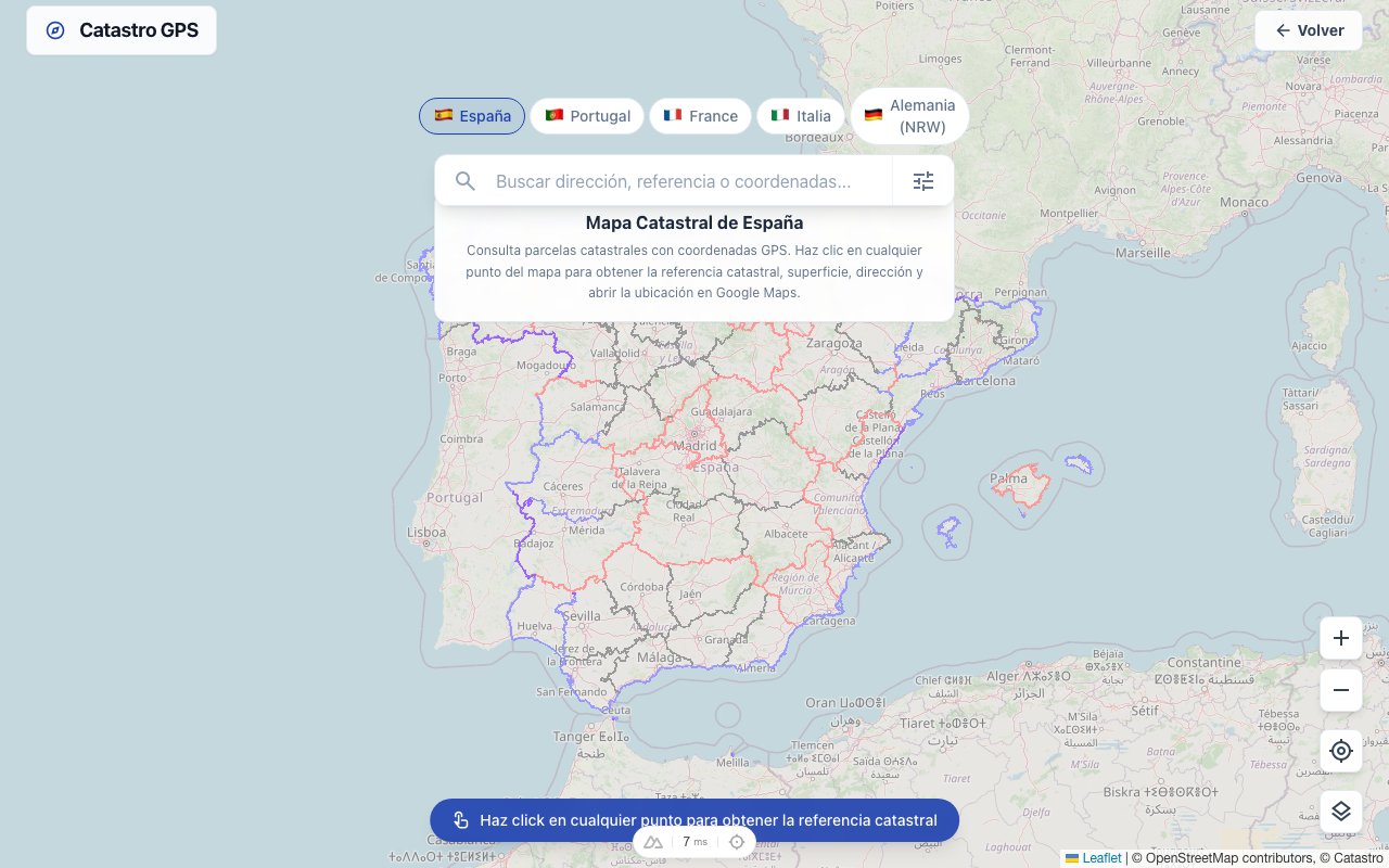 The cadastral boundary is laid over the satellite view, so you see the real situation straight away
Check the type of use
The cadastre records the official type of use of every parcel: arable land, grassland, building and open space, woodland, traffic area and so on.
That is useful when buying, to check whether the use claimed in the listing matches the cadastral record.
Prepare a land register search
To identify the competent land registry office, you need the parcel details. With the Gemarkung and Flurstück you can request the register folio directly through the local court system. Who can request a land register extract.
Check against the development plan
Some land-use plans (development plans, zoning plans) are structured by parcel. With the Flurstück number you can check exactly which planning zone your plot falls in.
Federal states: differences in the system
The cadastre is a matter for the federal states in Germany. There are common standards (ALKIS, the official cadastral information system), but implementation and access vary:
| Federal state | Cadastral authority | Online portal |
|---|---|---|
| NRW | District governments / cadastral offices | Geobasis NRW portal |
| Bavaria | Bavarian surveying administration | BayernAtlas |
| Baden-Württemberg | LGL Baden-Württemberg | Geoportal BW |
| Berlin | Senate administration | FIS-Broker |
Note: Kataster GPS shows the parcels of 15 federal states. Bavaria is missing because it does not make its cadastral data openly available.
Is the Flurstück number public?
Yes. The Liegenschaftskataster is a public register. The location, size and type of use of parcels are in principle publicly accessible.
Owner data, on the other hand, is protected: you need a legitimate interest to get information about the owner (for example notaries, lawyers, or in particular neighbour situations). Who owns a plot of land in Germany.
Summary
The Flurstück number is the heart of the German cadastre: a simple, logical identification system that uniquely describes every square metre of Germany.
Gemarkung + Flur + Flurstück = the unique location of a plot.
Once you have that triple, you can get the GPS coordinates straight away on the German cadastral map and show the plot in Google Maps, without detours through cadastral portals.
Frequently asked questions
Where is the Gemarkung in the land register extract? The Gemarkung is in the Bestandsverzeichnis, the first section of the land register extract. It lists every parcel in the register folio, each with its Gemarkung, Flur, Flurstück number, location and area. The wording typically looks like this: "Gemarkung Düsseldorf-Gerresheim, Flur 5, Flurstück 178".
Why does my plot have several Flurstück numbers? A plot in the legal sense (one register folio) can consist of several parcels. That often happens after land consolidation, divisions or historical mergers. The land register's inventory lists every parcel individually. So you have several cadastral units but one legal unit of ownership.
What does a Flurstück number written as 123/5 mean? The denominator (the 5 in "123/5") shows that this parcel was created by dividing an older parcel. The original parcel 123 was divided, and the resulting parts got the numbers 123/1, 123/2 and so on. It is purely historical and has no legal significance for current use.
Can I find the owner from the Flurstück number? A parcel's location and size are public cadastral data. Owner data is protected: it is in the land register and can only be inspected by people with a legitimate interest (e.g. notaries, lawyers, neighbours in certain situations). Kataster GPS does not return owner information.
What happens to the Flurstück number when I buy the plot? The Flurstück number stays the same: it belongs to the unit, not the owner. What changes is the entry in the land register (Section I: owner). The cadastre and the land register are updated independently.
My plot is in Bavaria: does all this apply in the same way? The basic principle (Gemarkung + Flur + Flurstück) applies throughout Germany under the ALKIS standard. There are, however, differences in implementation: in Bavaria and Baden-Württemberg the Flur is often left out because many Gemarkungen have only one. Kataster GPS does not show Bavarian parcels because the state does not make its cadastral data openly available; there, the BayernAtlas helps.