You have probably seen a reference like this in Portuguese deeds, property records and IMI tax returns:
"Rural property entered in the rural property register of the parish of X, under article 234 of section B"
Or simply: Artigo 4567-U (urban) or Artigo 234-R, secção B (rural).
That is the artigo matricial: the tax identification number of a property in Portugal.
What is the matriz predial?
The matriz predial is the register that the Finanças (the Tax and Customs Authority, AT) keeps of every property in Portugal.
It is mainly used for tax purposes:
- Calculating the Municipal Property Tax (IMI)
- Setting the Taxable Property Value (VPT)
- Identifying owners for tax purposes
Unlike the Registo Predial (the Land Registry, run by the Conservatórias, which legally proves ownership), the matriz predial is an administrative and tax register, not a title of ownership.
What is the artigo matricial?
The artigo matricial is the number that identifies each property in the matriz.
It is made up of:
- Article number: a whole number, assigned in sequence within the parish (freguesia)
- Section (rural properties only): a letter or group of letters that divides a parish into zones
- Type suffix: U for urban, R for rural (although in many old documents the suffix does not appear)
Examples:
Urban property: Artigo 4521-U, Freguesia de Cascais
Rural property: Artigo 123-R, Secção B, Freguesia de Alcoutim
For individual units (flats in a building under horizontal property):
Artigo 891-U, Fração AC, Freguesia do Lumiar
Artigo matricial vs land registry number
A very common confusion.
| Document | Where it is | What it is for |
|---|---|---|
| Artigo matricial | Finanças (AT) | Tax identification of the property |
| Description number (número de descrição) | Conservatória (Land Registry) | Legal proof of ownership |
| Unit codes (frações) | Conservatória | Identifying units in a condominium |
A property can have an up-to-date artigo matricial and an out-of-date registry entry (or the other way round). For any serious property transaction, you need to check both.
Where to find the artigo matricial
On the caderneta predial
The caderneta predial is the extract from the matriz predial, issued by the Finanças. It contains every detail of the property recorded in the matriz.
You can request it for free on the Portal das Finanças at portaldasfinancas.gov.pt with your NIF (tax number) and password, or the Chave Móvel Digital.
It is the most complete and current document for checking a property's details.
In the deed of sale
Every notarial deed of sale, gift or division of an inheritance mentions the property's artigo matricial.
In inheritance documents
In declarations of heirs (habilitações de herdeiros) and when a will is opened, properties are always identified by their artigo matricial.
On the IMI notice
The IMI assessment notice that the Finanças send every year shows the artigo matricial of each property you are paying for.
Changes to the artigo matricial
The artigo matricial is stable, but it can change in certain circumstances:
Splitting or merging
If you split a property in two (desanexação), each part gets a new artigo matricial. If you merge two properties, the old articles are cancelled and a new one is created.
Change of type
A rural property that becomes urban (because a subdivision is approved, for example) changes article: the rural one is cancelled and an urban one created.
Parish updates
After the administrative reforms of 2013, many parishes were merged. The articles stayed the same but became linked to the new administrative units.
What is the artigo matricial useful for outside the Finanças?
Finding the location
The artigo matricial on its own does not tell you where the property is: it is an administrative reference, not a geographic one.
To turn an artigo matricial into GPS coordinates and see the property on Google Maps, you can look up the land by its artigo matricial on Cadastro GPS (page in Portuguese), which matches the matriz data with the available cadastral mapping. The Catastro GPS app then takes you there and shows your position on the parcel.
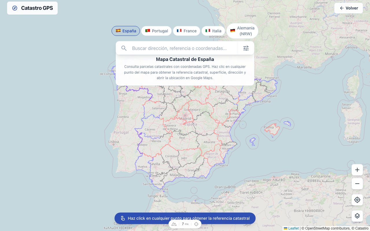 With the GPS coordinates you can see the parcel on satellite and understand the access, surroundings and terrain
Checking the neighbours
In old deeds, rural properties were described by their neighbours (confrontações): "bounded to the north by National Road X, to the south by article 45 of João Silva...". With the artigo matricial you can identify the neighbouring properties and check whether the described boundaries match reality.
Planning applications
Town councils (câmaras municipais) and other bodies often ask for the artigo matricial in planning applications. With the matching GPS coordinates, preparing those files becomes much simpler.
Cadastro Predial vs Matriz Predial: what is the difference?
Two systems coexist in Portugal:
Matriz Predial (Finanças): a tax register covering the whole country, based on owners' declarations and tax assessments.
Cadastro Predial (BUPi / IRN): a geometric register with precise parcel boundaries. It only exists in part of the country. It is more rigorous but less complete.
To locate a property on a map, the ideal is to have the georeferenced cadastral register. Where it does not exist, Cadastro GPS uses the best alternative mapping available.
Summary
| Concept | What it is |
|---|---|
| Matriz predial | Tax register of all properties, managed by the Finanças |
| Artigo matricial | A property's identification number in the matriz |
| Caderneta predial | Extract from the matriz with all the property's details |
| Registo predial | Legal register of ownership, managed by the Conservatórias |
| BUPi / Cadastro predial | Geometric register with coordinates, still incomplete |
Knowing the difference between these systems saves a lot of confusion, and a lot of time spent looking for documents in the wrong place.
If you want to find a property on the map from its artigo matricial, look it up by article and parish: Cadastro GPS shows the property in seconds.
Frequently asked questions
Does the artigo matricial change when I sell the property? No. The artigo matricial identifies the property, not the owner. In a sale, what changes is the holder recorded in the matriz (the notary notifies the Finanças) and in the Land Registry. The article number stays the same, unless the property is split, merged or changes type (from rural to urban, for example).
How do I get the caderneta predial of a property that is not mine? For your own properties you can request it for free on the Portal das Finanças with your NIF and password. For someone else's property you need to show a legitimate interest, for example as a prospective buyer, an heir or a party to court proceedings. In that case the request can be made in person at a tax office (Serviço de Finanças).
Are the artigo matricial and the registry description the same thing? No. The artigo matricial identifies the property in the Finanças (AT) matriz: it is a tax code. The descrição predial is the property's registration number at the Conservatória do Registo Predial: it is a legal code. They are parallel, independent systems. In a sale, the notary checks that the two agree.
What is a fração autónoma and how is it identified? A fração autónoma is an independent unit in a building under horizontal property, typically a flat or a shop. It is identified by the urban artigo matricial plus a unit code (e.g. Artigo 891-U, Fração AC). The unit code follows an alphanumeric sequence assigned when the horizontal property was set up.
Why does my artigo matricial start with different letters in old documents? In documents from before the Tax Authority was computerised (1990s-2000s), rural properties were identified with the cadastral section as a prefix (e.g. Artigo B-123). The section still exists for rural properties today, but it is presented slightly differently in the Finanças' digital documents. The number itself does not change.
How do I know whether a property is registered in BUPi? You can check on the BUPi website whether the parish where the property lies has cadastral coverage. BUPi publishes an up-to-date coverage map. If the area is not yet covered, the data available to locate it is general mapping, less precise than an official GPS delimitation.